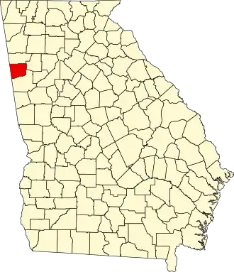
Haralson County
| County in de Verenigde Staten | |||
|---|---|---|---|
| |||
| Situering | |||
| Staat | Georgia | ||
| Coördinaten | 33°47'24"NB, 85°12'36"WL | ||
| Algemeen | |||
| Oppervlakte | 734 km² | ||
| - land | 731 km² | ||
| - water | 3 km² | ||
| Inwoners (2000) |
25.690 (35 inw./km²) | ||
| Overig | |||
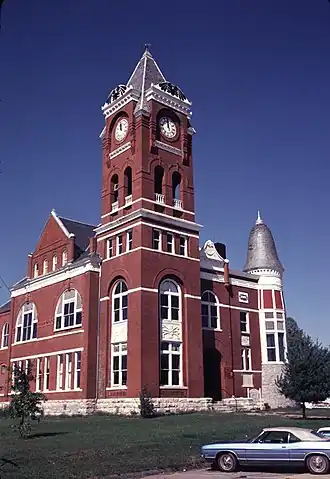
| Zetel | Buchanan | ||
| FIPS-code | 13143 | ||
| Opgericht | 1856 | ||
| Website | www | ||
| Foto's | |||
| |||
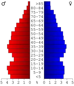 Bevolkingspiramide Haralson County | |||
| Statistieken volkstelling Haralson County | |||
| |||
Haralson County is een county in de Amerikaanse staat Georgia.
De county heeft een landoppervlakte van 731 km² en telt 25.690 inwoners (volkstelling 2000). De hoofdplaats is Buchanan.
Bevolkingsontwikkeling
| Jaar | Inwoners | % ± | |
|---|---|---|---|
| 1900 | 11.922 | — | |
| 1910 | 13.514 | 13,4% | |
| 1920 | 14.440 | 6,9% | |
| 1930 | 13.263 | −8,2% | |
| 1940 | 14.377 | 8,4% | |
| 1950 | 14.663 | 2,0% | |
| 1960 | 14.543 | −0,8% | |
| 1970 | 15.927 | 9,5% | |
| 1980 | 18.422 | 15,7% | |
| 1990 | 21.966 | 19,2% | |
| 2000 | 25.690 | 17,0% | |
| Bron: (en) Historical Decennial Census Population | |||