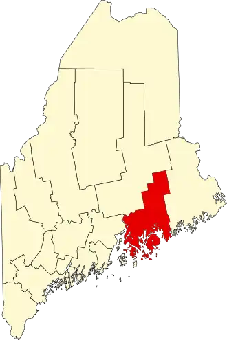
Hancock County (Maine)
| County in de Verenigde Staten | |||
|---|---|---|---|
| |||
| Situering | |||
| Staat | Maine | ||
| Coördinaten | 44°30'45,868"NB, 68°24'56,556"WL | ||
| Algemeen | |||
| Oppervlakte | 6.089 km² | ||
| - land | 4.112 km² | ||
| - water | 1.977 km² | ||
| Inwoners (2000) |
51.791 (13 inw./km²) | ||
| Overig | |||
| Zetel | Ellsworth | ||
| FIPS-code | 23009 | ||
| Website | hancockcountymaine | ||
| Foto's | |||

| |||
 Bevolkingspiramide Hancock County | |||
| Statistieken volkstelling Hancock County | |||
| |||
Hancock County is een county in de Amerikaanse staat Maine.
De county heeft een landoppervlakte van 4.112 km² en telt 51.791 inwoners (volkstelling 2000). De hoofdplaats is Ellsworth.
Bevolkingsontwikkeling
| Jaar | Inwoners | % ± | |
|---|---|---|---|
| 1900 | 37.241 | — | |
| 1910 | 35.575 | −4,5% | |
| 1920 | 30.361 | −14,7% | |
| 1930 | 30.721 | 1,2% | |
| 1940 | 32.422 | 5,5% | |
| 1950 | 32.105 | −1,0% | |
| 1960 | 32.293 | 0,6% | |
| 1970 | 34.590 | 7,1% | |
| 1980 | 41.781 | 20,8% | |
| 1990 | 46.948 | 12,4% | |
| 2000 | 51.791 | 10,3% | |
| Bron: (en) Historical Decennial Census Population | |||