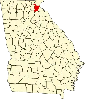
Habersham County
| County in de Verenigde Staten | |||
|---|---|---|---|
| |||
| Situering | |||
| Staat | Georgia | ||
| Coördinaten | 34°37'48"NB, 83°31'48"WL | ||
| Algemeen | |||
| Oppervlakte | 723 km² | ||
| - land | 720 km² | ||
| - water | 3 km² | ||
| Inwoners (2000) |
35.902 (50 inw./km²) | ||
| Overig | |||
| Zetel | Clarkesville | ||
| FIPS-code | 13137 | ||
| Opgericht | 1818 | ||
| Website | www | ||
| Foto's | |||

| |||
 Bevolkingspiramide Habersham County | |||
| Statistieken volkstelling Habersham County | |||
| |||
Habersham County is een county in de Amerikaanse staat Georgia.
De county heeft een landoppervlakte van 720 km² en telt 35.902 inwoners (volkstelling 2000). De hoofdplaats is Clarkesville.
Bevolkingsontwikkeling
| Jaar | Inwoners | % ± | |
|---|---|---|---|
| 1900 | 13.604 | — | |
| 1910 | 10.134 | −25,5% | |
| 1920 | 10.730 | 5,9% | |
| 1930 | 12.748 | 18,8% | |
| 1940 | 14.771 | 15,9% | |
| 1950 | 16.553 | 12,1% | |
| 1960 | 18.116 | 9,4% | |
| 1970 | 20.691 | 14,2% | |
| 1980 | 25.020 | 20,9% | |
| 1990 | 27.621 | 10,4% | |
| 2000 | 35.902 | 30,0% | |
| Bron: (en) Historical Decennial Census Population | |||