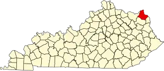
Greenup County
| County in de Verenigde Staten | |||
|---|---|---|---|
| |||
| Situering | |||
| Staat | Kentucky | ||
| Coördinaten | 38°32'24"NB, 82°55'12"WL | ||
| Algemeen | |||
| Oppervlakte | 918 km² | ||
| - land | 896 km² | ||
| - water | 22 km² | ||
| Inwoners (2000) |
36.891 (41 inw./km²) | ||
| Overig | |||
| Zetel | Greenup | ||
| FIPS-code | 21089 | ||
| Opgericht | 1803 | ||
| Website | www | ||
| Foto's | |||
| |||
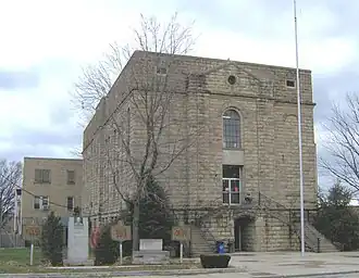
| Greenup County Courthouse | |||
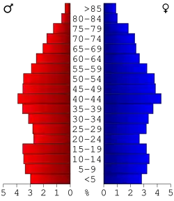 Bevolkingspiramide Greenup County | |||
| Statistieken volkstelling Greenup County | |||
| |||
Greenup County is een county in de Amerikaanse staat Kentucky.
De county heeft een landoppervlakte van 896 km² en telt 36.891 inwoners (volkstelling 2000). De hoofdplaats is Greenup.
Bevolkingsontwikkeling
| Jaar | Inwoners | % ± | |
|---|---|---|---|
| 1900 | 15.432 | — | |
| 1910 | 18.475 | 19,7% | |
| 1920 | 20.062 | 8,6% | |
| 1930 | 24.554 | 22,4% | |
| 1940 | 24.917 | 1,5% | |
| 1950 | 24.887 | −0,1% | |
| 1960 | 29.238 | 17,5% | |
| 1970 | 33.192 | 13,5% | |
| 1980 | 39.132 | 17,9% | |
| 1990 | 36.742 | −6,1% | |
| 2000 | 36.891 | 0,4% | |
| Bron: (en) Historical Decennial Census Population | |||