Greene County (Missouri)
| County in de Verenigde Staten | |||
|---|---|---|---|
| |||
| Situering | |||
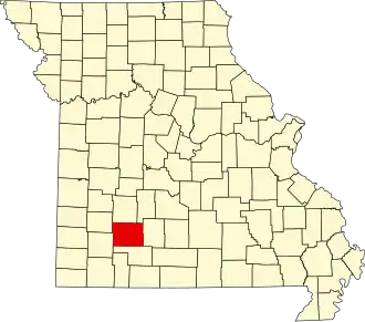
| Staat | Missouri | ||
| Coördinaten | 37°15'36"NB, 93°20'24"WL | ||
| Algemeen | |||
| Oppervlakte | 1.755 km² | ||
| - land | 1.748 km² | ||
| - water | 7 km² | ||
| Inwoners (2000) |
240.391 (138 inw./km²) | ||
| Overig | |||
| Zetel | Springfield | ||
| FIPS-code | 29077 | ||
| Opgericht | 1833 | ||
| Website | www | ||
| Foto's | |||

| |||
 Bevolkingspiramide Greene County | |||
| Statistieken volkstelling Greene County | |||
| |||
Greene County is een county in de Amerikaanse staat Missouri.
De county heeft een landoppervlakte van 1.748 km² en telt 240.391 inwoners (volkstelling 2000). De hoofdplaats is Springfield.
Bevolkingsontwikkeling
| Jaar | Inwoners | % ± | |
|---|---|---|---|
| 1900 | 52.713 | — | |
| 1910 | 63.831 | 21,1% | |
| 1920 | 68.698 | 7,6% | |
| 1930 | 82.929 | 20,7% | |
| 1940 | 90.541 | 9,2% | |
| 1950 | 104.823 | 15,8% | |
| 1960 | 126.276 | 20,5% | |
| 1970 | 152.929 | 21,1% | |
| 1980 | 185.302 | 21,2% | |
| 1990 | 207.949 | 12,2% | |
| 2000 | 240.391 | 15,6% | |
| Bron: (en) Historical Decennial Census Population | |||