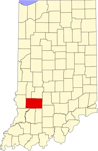
Greene County (Indiana)
| County in de Verenigde Staten | |||
|---|---|---|---|
| |||
| Situering | |||
| Staat | Indiana | ||
| Coördinaten | 39°2'24"NB, 86°58'12"WL | ||
| Algemeen | |||
| Oppervlakte | 1.414 km² | ||
| - land | 1.403 km² | ||
| - water | 11 km² | ||
| Inwoners (2000) |
33.157 (24 inw./km²) | ||
| Overig | |||
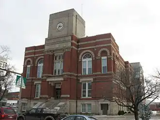
| Zetel | Bloomfield | ||
| FIPS-code | 18055 | ||
| Opgericht | 1821 | ||
| Website | www | ||
| Foto's | |||

| |||
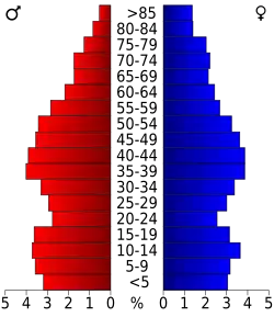 Bevolkingspiramide Greene County | |||
| Statistieken volkstelling Greene County | |||
| |||
Greene County is een county in de Amerikaanse staat Indiana.
De county heeft een landoppervlakte van 1.403 km² en telt 33.157 inwoners (volkstelling 2000). De hoofdplaats is Bloomfield.
Bevolkingsontwikkeling
| Jaar | Inwoners | % ± | |
|---|---|---|---|
| 1900 | 28.530 | — | |
| 1910 | 36.873 | 29,2% | |
| 1920 | 36.770 | −0,3% | |
| 1930 | 31.481 | −14,4% | |
| 1940 | 31.330 | −0,5% | |
| 1950 | 27.886 | −11,0% | |
| 1960 | 26.327 | −5,6% | |
| 1970 | 26.894 | 2,2% | |
| 1980 | 30.416 | 13,1% | |
| 1990 | 30.410 | −0,0% | |
| 2000 | 33.157 | 9,0% | |
| Bron: (en) Historical Decennial Census Population | |||