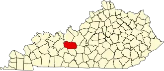
Grayson County (Kentucky)
| County in de Verenigde Staten | |||
|---|---|---|---|
| |||
| Situering | |||
| Staat | Kentucky | ||
| Coördinaten | 37°27'36"NB, 86°21'0"WL | ||
| Algemeen | |||
| Oppervlakte | 1.324 km² | ||
| - land | 1.305 km² | ||
| - water | 19 km² | ||
| Inwoners (2000) |
24.053 (18 inw./km²) | ||
| Overig | |||
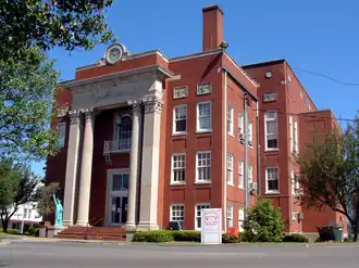
| Zetel | Leitchfield | ||
| FIPS-code | 21085 | ||
| Opgericht | 1810 | ||
| Website | www | ||
| Foto's | |||
| |||
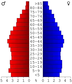 Bevolkingspiramide Grayson County | |||
| Statistieken volkstelling Grayson County | |||
| |||
Grayson County is een county in de Amerikaanse staat Kentucky.
De county heeft een landoppervlakte van 1.305 km² en telt 24.053 inwoners (volkstelling 2000). De hoofdplaats is Leitchfield.
Bevolkingsontwikkeling
| Jaar | Inwoners | % ± | |
|---|---|---|---|
| 1900 | 19.878 | — | |
| 1910 | 19.958 | 0,4% | |
| 1920 | 19.927 | −0,2% | |
| 1930 | 17.055 | −14,4% | |
| 1940 | 17.562 | 3,0% | |
| 1950 | 17.063 | −2,8% | |
| 1960 | 15.834 | −7,2% | |
| 1970 | 16.445 | 3,9% | |
| 1980 | 20.854 | 26,8% | |
| 1990 | 21.050 | 0,9% | |
| 2000 | 24.053 | 14,3% | |
| Bron: (en) Historical Decennial Census Population | |||