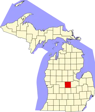
Gratiot County
| County in de Verenigde Staten | |||
|---|---|---|---|
| |||
| Situering | |||
| Staat | Michigan | ||
| Coördinaten | 43°17'24"NB, 84°36'0"WL | ||
| Algemeen | |||
| Oppervlakte | 1.481 km² | ||
| - land | 1.477 km² | ||
| - water | 4 km² | ||
| Inwoners (2000) |
42.285 (29 inw./km²) | ||
| Overig | |||
| Zetel | Ithaca | ||
| FIPS-code | 26057 | ||
| Opgericht | 1831 | ||
| Website | www | ||
| Foto's | |||

| |||
 Bevolkingspiramide Gratiot County | |||
| Statistieken volkstelling Gratiot County | |||
| |||
Gratiot County is een county in de Amerikaanse staat Michigan.
De county heeft een landoppervlakte van 1.477 km² en telt 42.285 inwoners (volkstelling 2000). De hoofdplaats is Ithaca.
Bevolkingsontwikkeling
| Jaar | Inwoners | % ± | |
|---|---|---|---|
| 1900 | 29.889 | — | |
| 1910 | 28.820 | −3,6% | |
| 1920 | 33.914 | 17,7% | |
| 1930 | 30.252 | −10,8% | |
| 1940 | 32.205 | 6,5% | |
| 1950 | 33.429 | 3,8% | |
| 1960 | 37.012 | 10,7% | |
| 1970 | 39.246 | 6,0% | |
| 1980 | 40.448 | 3,1% | |
| 1990 | 38.982 | −3,6% | |
| 2000 | 42.285 | 8,5% | |
| Bron: (en) Historical Decennial Census Population | |||