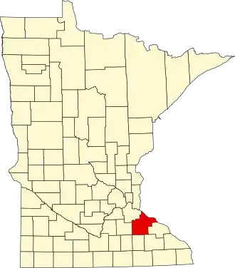
Goodhue County
| County in de Verenigde Staten | |||
|---|---|---|---|
| |||
| Situering | |||
| Staat | Minnesota | ||
| Coördinaten | 44°24'36"NB, 92°43'12"WL | ||
| Algemeen | |||
| Oppervlakte | 2.021 km² | ||
| - land | 1.964 km² | ||
| - water | 57 km² | ||
| Inwoners (2000) |
44.127 (22 inw./km²) | ||
| Overig | |||
| Zetel | Red Wing | ||
| FIPS-code | 27049 | ||
| Opgericht | 1853 | ||
| Website | www | ||
| Foto's | |||

| |||
 Bevolkingspiramide Goodhue County | |||
| Statistieken volkstelling Goodhue County | |||
| |||
Goodhue County is een county in de Amerikaanse staat Minnesota.
De county heeft een landoppervlakte van 1.964 km² en telt 44.127 inwoners (volkstelling 2000). De hoofdplaats is Red Wing.
Bevolkingsontwikkeling
| Jaar | Inwoners | % ± | |
|---|---|---|---|
| 1900 | 31.137 | — | |
| 1910 | 31.637 | 1,6% | |
| 1920 | 30.799 | −2,6% | |
| 1930 | 31.317 | 1,7% | |
| 1940 | 31.564 | 0,8% | |
| 1950 | 32.118 | 1,8% | |
| 1960 | 33.035 | 2,9% | |
| 1970 | 34.763 | 5,2% | |
| 1980 | 38.749 | 11,5% | |
| 1990 | 40.690 | 5,0% | |
| 2000 | 44.127 | 8,4% | |
| Bron: (en) Historical Decennial Census Population | |||