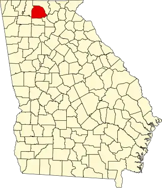
Gilmer County (Georgia)
| County in de Verenigde Staten | |||
|---|---|---|---|
| |||
| Situering | |||
| Staat | Georgia | ||
| Coördinaten | 34°41'24"NB, 84°27'36"WL | ||
| Algemeen | |||
| Oppervlakte | 1.118 km² | ||
| - land | 1.105 km² | ||
| - water | 13 km² | ||
| Inwoners (2000) |
23.456 (21 inw./km²) | ||
| Overig | |||
| Zetel | Ellijay | ||
| FIPS-code | 13123 | ||
| Opgericht | 1832 | ||
| Website | www | ||
| Foto's | |||

| |||
 Bevolkingspiramide Gilmer County | |||
| Statistieken volkstelling Gilmer County | |||
| |||
Gilmer County is een county in de Amerikaanse staat Georgia.
De county heeft een landoppervlakte van 1.105 km² en telt 23.456 inwoners (volkstelling 2000). De hoofdplaats is Ellijay.
In de county ligt de berg Big Bald Mountain in het Chattahoochee-Oconee National Forest.
Bevolkingsontwikkeling
| Jaar | Inwoners | % ± | |
|---|---|---|---|
| 1900 | 10.198 | — | |
| 1910 | 9.237 | −9,4% | |
| 1920 | 8.406 | −9,0% | |
| 1930 | 7.344 | −12,6% | |
| 1940 | 9.001 | 22,6% | |
| 1950 | 9.963 | 10,7% | |
| 1960 | 8.922 | −10,4% | |
| 1970 | 8.956 | 0,4% | |
| 1980 | 11.110 | 24,1% | |
| 1990 | 13.368 | 20,3% | |
| 2000 | 23.456 | 75,5% | |
| Bron: (en) Historical Decennial Census Population | |||