Fresnes (Loir-et-Cher)
| Gemeente in Frankrijk | |||
|---|---|---|---|
 | |||
| Situering | |||
| Regio | Centre-Val de Loire | ||
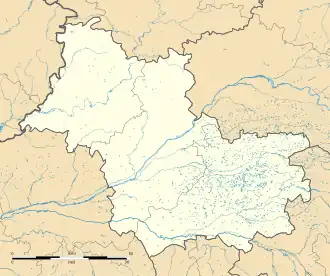
| Departement | Loir-et-Cher (41) | ||
| Arrondissement | Romorantin-Lanthenay | ||
| Kanton | Montrichard Val de Cher | ||
| Coördinaten | 47° 26′ NB, 1° 25′ OL | ||
| Algemeen | |||
| Oppervlakte | 16,02 km² | ||
| Inwoners (1 januari 2022) |
1.199[1] (75 inw./km²) | ||
| Hoogte | 86 - 112 m | ||
| Overig | |||
| Postcode | 41700 | ||
| INSEE-code | 41094 | ||
| Website | Officiële website | ||
| Detailkaart | |||
 | |||
| Foto's | |||
_01.JPG)
| |||
| Gemeentehuis | |||
| |||
Fresnes is een gemeente in het Franse departement Loir-et-Cher in de regio Centre-Val de Loire. De gemeente telde 1.199 inwoners op 1 januari 2022.[1]
Geschiedenis
Fresnes maakte deel uit van het arrondissement Blois tot de gemeente op 1 januari 2017 werd overgeheveld naar het arrondissement Romorantin-Lanthenay.
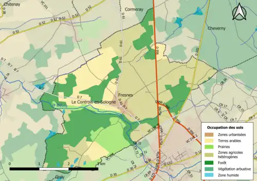
Geografie
De oppervlakte van Fresnes bedraagt 16,02 vierkante kilometer; Op 1 januari 2022 was de bevolkingsdichtheid 74,8 inwoners per km².
Demografie
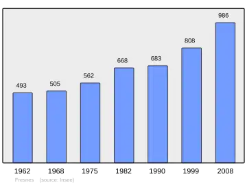
Onderstaande figuur toont het verloop van het inwonertal.[2]
Bronnen, noten en/of referenties
- ↑ a b Populations de référence 2022.
- ↑ (fr) Statistische informatie op de website van het Franse bureau voor statistiek INSEE, cijfers inwoneraantal volgens de definitie "population sans doubles comptes"
Zie de categorie Fresnes (Loir-et-Cher) van Wikimedia Commons voor mediabestanden over dit onderwerp.