Fayette County (Kentucky)
| County in de Verenigde Staten | |||
|---|---|---|---|
| |||
| Situering | |||
| Staat | Kentucky | ||
| Coördinaten | 38°2'24"NB, 84°27'36"WL | ||
| Algemeen | |||
| Oppervlakte | 740 km² | ||
| - land | 737 km² | ||
| - water | 3 km² | ||
| Inwoners (2000) |
260.512 (353 inw./km²) | ||
| Overig | |||
| Zetel | Lexington | ||
| FIPS-code | 21067 | ||
| Opgericht | 1780 | ||
| Website | www | ||
| Foto's | |||

| |||
 Bevolkingspiramide Fayette County | |||
| Statistieken volkstelling Fayette County | |||
| |||
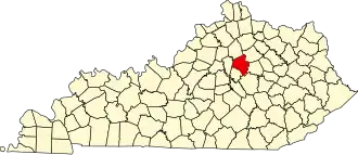
Fayette County is een county in de Amerikaanse staat Kentucky.
De county heeft een landoppervlakte van 737 km² en telt 260.512 inwoners (volkstelling 2000). De hoofdplaats is Lexington.
Bevolkingsontwikkeling
| Jaar | Inwoners | % ± | |
|---|---|---|---|
| 1900 | 42.071 | — | |
| 1910 | 47.715 | 13,4% | |
| 1920 | 54.664 | 14,6% | |
| 1930 | 68.543 | 25,4% | |
| 1940 | 78.899 | 15,1% | |
| 1950 | 100.746 | 27,7% | |
| 1960 | 131.906 | 30,9% | |
| 1970 | 174.323 | 32,2% | |
| 1980 | 204.165 | 17,1% | |
| 1990 | 225.366 | 10,4% | |
| 2000 | 260.512 | 15,6% | |
| Bron: (en) Historical Decennial Census Population | |||