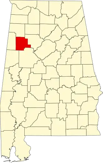
Fayette County (Alabama)
| County in de Verenigde Staten | |||
|---|---|---|---|
| |||
| Situering | |||
| Staat | Alabama | ||
| Coördinaten | 33°43'12"NB, 87°44'19"WL | ||
| Algemeen | |||
| Oppervlakte | 1.630 km² | ||
| - land | 1.626 km² | ||
| - water | 4 km² | ||
| Inwoners (2000) |
18.495 (11 inw./km²) | ||
| Overig | |||
| Zetel | Fayette | ||
| FIPS-code | 01057 | ||
| Opgericht | 1824 | ||
| Website | www | ||
| Foto's | |||

| |||
 Bevolkingspiramide Fayette County | |||
| Statistieken volkstelling Fayette County | |||
| |||
Fayette County is een county in de Amerikaanse staat Alabama.
De county heeft een landoppervlakte van 1.626 km² en telt 18.495 inwoners (volkstelling 2000). De hoofdplaats is Fayette.
Bevolkingsontwikkeling
| Jaar | Inwoners | % ± | |
|---|---|---|---|
| 1900 | 14.132 | — | |
| 1910 | 16.248 | 15,0% | |
| 1920 | 18.365 | 13,0% | |
| 1930 | 18.443 | 0,4% | |
| 1940 | 21.651 | 17,4% | |
| 1950 | 19.388 | −10,5% | |
| 1960 | 16.148 | −16,7% | |
| 1970 | 16.252 | 0,6% | |
| 1980 | 18.809 | 15,7% | |
| 1990 | 17.962 | −4,5% | |
| 2000 | 18.495 | 3,0% | |
| Bron: (en) Historical Decennial Census Population | |||