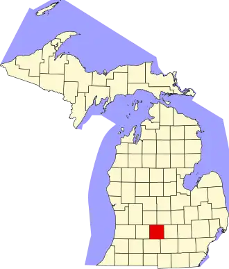
Eaton County
| County in de Verenigde Staten | |||
|---|---|---|---|
| |||
| Situering | |||
| Staat | Michigan | ||
| Coördinaten | 42°35'24"NB, 84°51'0"WL | ||
| Algemeen | |||
| Oppervlakte | 1.500 km² | ||
| - land | 1.493 km² | ||
| - water | 7 km² | ||
| Inwoners (2000) |
103.655 (69 inw./km²) | ||
| Overig | |||
| Zetel | Charlotte | ||
| FIPS-code | 26045 | ||
| Opgericht | 1829 | ||
| Website | www | ||
| Foto's | |||

| |||
 Bevolkingspiramide Eaton County | |||
| Statistieken volkstelling Eaton County | |||
| |||
Eaton County is een county in de Amerikaanse staat Michigan.
De county heeft een landoppervlakte van 1.493 km² en telt 103.655 inwoners (volkstelling 2000). De hoofdplaats is Charlotte.
Bevolkingsontwikkeling
| Jaar | Inwoners | % ± | |
|---|---|---|---|
| 1900 | 31.668 | — | |
| 1910 | 30.499 | −3,7% | |
| 1920 | 29.377 | −3,7% | |
| 1930 | 31.728 | 8,0% | |
| 1940 | 34.124 | 7,6% | |
| 1950 | 40.023 | 17,3% | |
| 1960 | 49.684 | 24,1% | |
| 1970 | 68.892 | 38,7% | |
| 1980 | 88.337 | 28,2% | |
| 1990 | 92.879 | 5,1% | |
| 2000 | 103.655 | 11,6% | |
| Bron: (en) Historical Decennial Census Population | |||