Douglas County (Missouri)
| County in de Verenigde Staten | |||
|---|---|---|---|
| |||
| Situering | |||
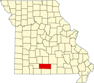
| Staat | Missouri | ||
| Coördinaten | 36°55'48"NB, 92°30'0"WL | ||
| Algemeen | |||
| Oppervlakte | 2.110 km² | ||
| - land | 2.110 km² | ||
| - water | 0 km² | ||
| Inwoners (2000) |
13.084 (6 inw./km²) | ||
| Overig | |||
| Zetel | Ava | ||
| FIPS-code | 29067 | ||
| Opgericht | 1857 | ||
| Foto's | |||

| |||
 Bevolkingspiramide Douglas County | |||
| Statistieken volkstelling Douglas County | |||
| |||
Douglas County is een county in de Amerikaanse staat Missouri.
De county heeft een landoppervlakte van 2.110 km² en telt 13.084 inwoners (volkstelling 2000). De hoofdplaats is Ava.
Bevolkingsontwikkeling
| Jaar | Inwoners | % ± | |
|---|---|---|---|
| 1900 | 16.802 | — | |
| 1910 | 16.664 | −0,8% | |
| 1920 | 15.436 | −7,4% | |
| 1930 | 13.959 | −9,6% | |
| 1940 | 15.600 | 11,8% | |
| 1950 | 12.638 | −19,0% | |
| 1960 | 9.653 | −23,6% | |
| 1970 | 9.268 | −4,0% | |
| 1980 | 11.594 | 25,1% | |
| 1990 | 11.876 | 2,4% | |
| 2000 | 13.084 | 10,2% | |
| Bron: (en) Historical Decennial Census Population | |||