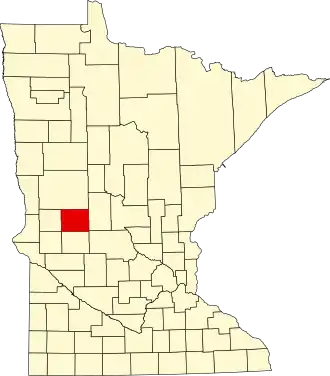
Douglas County (Minnesota)
| County in de Verenigde Staten | |||
|---|---|---|---|
| |||
| Situering | |||
| Staat | Minnesota | ||
| Coördinaten | 45°56'24"NB, 95°27'0"WL | ||
| Algemeen | |||
| Oppervlakte | 1.865 km² | ||
| - land | 1.643 km² | ||
| - water | 222 km² | ||
| Inwoners (2000) |
32.821 (20 inw./km²) | ||
| Overig | |||
| Zetel | Alexandria | ||
| FIPS-code | 27041 | ||
| Opgericht | 1858 | ||
| Website | www | ||
| Foto's | |||

| |||
 Bevolkingspiramide Douglas County | |||
| Statistieken volkstelling Douglas County | |||
| |||
Douglas County is een county in de Amerikaanse staat Minnesota.
De county heeft een landoppervlakte van 1.643 km² en telt 32.821 inwoners (volkstelling 2000). De hoofdplaats is Alexandria.
Bevolkingsontwikkeling
| Jaar | Inwoners | % ± | |
|---|---|---|---|
| 1900 | 17.964 | — | |
| 1910 | 17.669 | −1,6% | |
| 1920 | 19.039 | 7,8% | |
| 1930 | 18.813 | −1,2% | |
| 1940 | 20.369 | 8,3% | |
| 1950 | 21.304 | 4,6% | |
| 1960 | 21.313 | 0,0% | |
| 1970 | 22.892 | 7,4% | |
| 1980 | 27.839 | 21,6% | |
| 1990 | 28.674 | 3,0% | |
| 2000 | 32.821 | 14,5% | |
| Bron: (en) Historical Decennial Census Population | |||