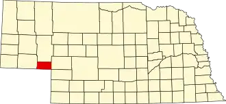
Deuel County (Nebraska)
| County in de Verenigde Staten | |||
|---|---|---|---|
| |||
| Situering | |||
| Staat | Nebraska | ||
| Coördinaten | 41°6'36"NB, 102°19'48"WL | ||
| Algemeen | |||
| Oppervlakte | 1.141 km² | ||
| - land | 1.139 km² | ||
| - water | 2 km² | ||
| Inwoners (2000) |
2.098 (2 inw./km²) | ||
| Overig | |||
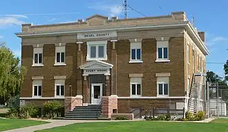
| Zetel | Chappell | ||
| FIPS-code | 31049 | ||
| Opgericht | 1889 | ||
| Website | www | ||
| Foto's | |||
| |||
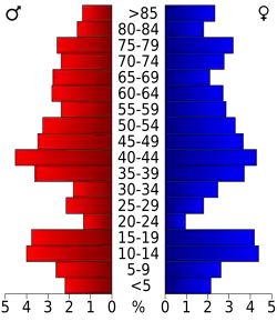 Bevolkingspiramide Deuel County | |||
| Statistieken volkstelling Deuel County | |||
| |||
Deuel County is een county in de Amerikaanse staat Nebraska.
De county heeft een landoppervlakte van 1.139 km² en telt 2.098 inwoners (volkstelling 2000). De hoofdplaats is Chappell.
Bevolkingsontwikkeling
| Jaar | Inwoners | % ± | |
|---|---|---|---|
| 1900 | 2.630 | — | |
| 1910 | 1.786 | −32,1% | |
| 1920 | 3.282 | 83,8% | |
| 1930 | 3.992 | 21,6% | |
| 1940 | 3.580 | −10,3% | |
| 1950 | 3.330 | −7,0% | |
| 1960 | 3.125 | −6,2% | |
| 1970 | 2.717 | −13,1% | |
| 1980 | 2.462 | −9,4% | |
| 1990 | 2.237 | −9,1% | |
| 2000 | 2.098 | −6,2% | |
| Bron: (en) Historical Decennial Census Population | |||