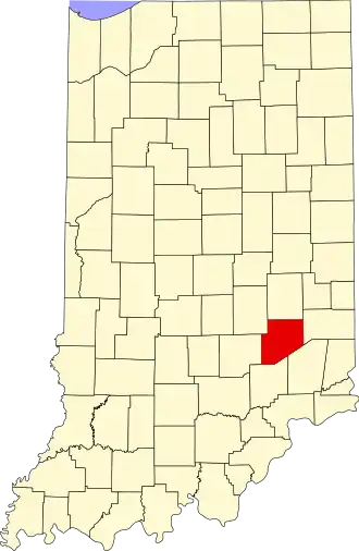
Decatur County (Indiana)
| County in de Verenigde Staten | |||
|---|---|---|---|
| |||
| Situering | |||
| Staat | Indiana | ||
| Coördinaten | 39°18'NB, 85°30'WL | ||
| Algemeen | |||
| Oppervlakte | 967 km² | ||
| - land | 965 km² | ||
| - water | 2 km² | ||
| Inwoners (2000) |
24.555 (25 inw./km²) | ||
| Overig | |||
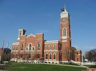
| Zetel | Greensburg | ||
| FIPS-code | 18031 | ||
| Opgericht | 1821 | ||
| Website | www | ||
| Foto's | |||
| |||
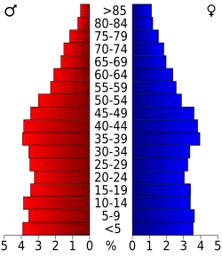 Bevolkingspiramide Decatur County | |||
| Statistieken volkstelling Decatur County | |||
| |||
Decatur County is een county in de Amerikaanse staat Indiana.
De county heeft een landoppervlakte van 965 km² en telt 24.555 inwoners (volkstelling 2000). De hoofdplaats is Greensburg.
Bevolkingsontwikkeling
| Jaar | Inwoners | % ± | |
|---|---|---|---|
| 1900 | 19.518 | — | |
| 1910 | 18.793 | −3,7% | |
| 1920 | 17.813 | −5,2% | |
| 1930 | 17.308 | −2,8% | |
| 1940 | 17.722 | 2,4% | |
| 1950 | 18.218 | 2,8% | |
| 1960 | 20.019 | 9,9% | |
| 1970 | 22.738 | 13,6% | |
| 1980 | 23.841 | 4,9% | |
| 1990 | 23.645 | −0,8% | |
| 2000 | 24.555 | 3,8% | |
| Bron: (en) Historical Decennial Census Population | |||