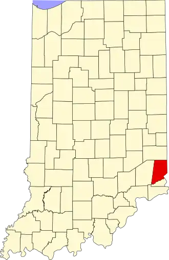
Dearborn County
| County in de Verenigde Staten | |||
|---|---|---|---|
| |||
| Situering | |||
| Staat | Indiana | ||
| Coördinaten | 39°9'0"NB, 84°58'48"WL | ||
| Algemeen | |||
| Oppervlakte | 795 km² | ||
| - land | 790 km² | ||
| - water | 5 km² | ||
| Inwoners (2000) |
46.109 (58 inw./km²) | ||
| Overig | |||
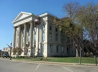
| Zetel | Lawrenceburg | ||
| FIPS-code | 18029 | ||
| Opgericht | 1803 | ||
| Website | www | ||
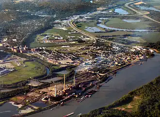
| Foto's | |||
| |||
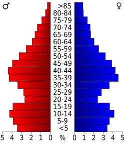 Bevolkingspiramide Dearborn County | |||
| Statistieken volkstelling Dearborn County | |||
| |||
Dearborn County is een county in de Amerikaanse staat Indiana.
De county heeft een landoppervlakte van 790 km² en telt 46.109 inwoners (volkstelling 2000). De hoofdplaats is Lawrenceburg.
Bevolkingsontwikkeling
| Jaar | Inwoners | % ± | |
|---|---|---|---|
| 1900 | 22.194 | — | |
| 1910 | 21.396 | −3,6% | |
| 1920 | 20.033 | −6,4% | |
| 1930 | 21.056 | 5,1% | |
| 1940 | 23.053 | 9,5% | |
| 1950 | 25.141 | 9,1% | |
| 1960 | 28.674 | 14,1% | |
| 1970 | 29.430 | 2,6% | |
| 1980 | 34.291 | 16,5% | |
| 1990 | 38.835 | 13,3% | |
| 2000 | 46.109 | 18,7% | |
| Bron: (en) Historical Decennial Census Population | |||