DeKalb County (Missouri)
| County in de Verenigde Staten | |||
|---|---|---|---|
| |||
| Situering | |||
| Staat | Missouri | ||
| Coördinaten | 39°54'NB, 94°24'WL | ||
| Algemeen | |||
| Oppervlakte | 1.103 km² | ||
| - land | 1.099 km² | ||
| - water | 4 km² | ||
| Inwoners (2000) |
11.597 (11 inw./km²) | ||
| Overig | |||
| Zetel | Maysville | ||
| FIPS-code | 29063 | ||
| Opgericht | 1845 | ||
| Website | www | ||
| Foto's | |||
.JPG)
| |||
 Bevolkingspiramide DeKalb County | |||
| Statistieken volkstelling DeKalb County | |||
| |||
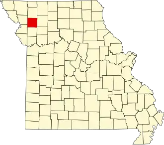
DeKalb County is een county in de Amerikaanse staat Missouri.
De county heeft een landoppervlakte van 1.099 km² en telt 11.597 inwoners (volkstelling 2000). De hoofdplaats is Maysville.
Bevolkingsontwikkeling
| Jaar | Inwoners | % ± | |
|---|---|---|---|
| 1900 | 14.418 | — | |
| 1910 | 12.531 | −13,1% | |
| 1920 | 11.694 | −6,7% | |
| 1930 | 10.270 | −12,2% | |
| 1940 | 9.751 | −5,1% | |
| 1950 | 8.047 | −17,5% | |
| 1960 | 7.226 | −10,2% | |
| 1970 | 7.305 | 1,1% | |
| 1980 | 8.222 | 12,6% | |
| 1990 | 9.967 | 21,2% | |
| 2000 | 11.597 | 16,4% | |
| Bron: (en) Historical Decennial Census Population | |||