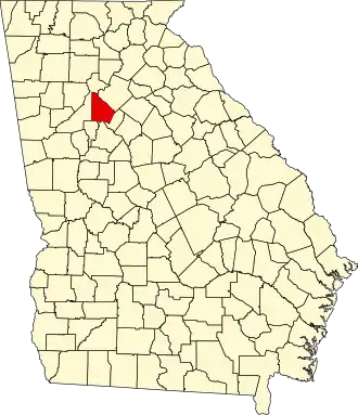
DeKalb County (Georgia)
| County in de Verenigde Staten | |||
|---|---|---|---|
| |||
| Situering | |||
| Staat | Georgia | ||
| Coördinaten | 33°46'12"NB, 84°13'48"WL | ||
| Algemeen | |||
| Oppervlakte | 702 km² | ||
| - land | 695 km² | ||
| - water | 7 km² | ||
| Inwoners (2000) |
665.865 (958 inw./km²) | ||
| Overig | |||
| Zetel | Decatur | ||
| FIPS-code | 13089 | ||
| Opgericht | 1822 | ||
| Website | https://www.co.dekalb.ga.us/ | ||
| Foto's | |||

| |||
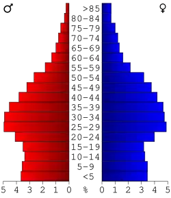 Bevolkingspiramide DeKalb County | |||
| Statistieken volkstelling DeKalb County | |||
| |||
DeKalb County is een county in de Amerikaanse staat Georgia.
De county heeft een landoppervlakte van 695 km² en telt 665.865 inwoners (volkstelling 2000). De hoofdplaats is Decatur.
In de county ligt de berg Stone Mountain.
Bevolkingsontwikkeling
| Jaar | Inwoners | % ± | |
|---|---|---|---|
| 1900 | 21.112 | — | |
| 1910 | 27.881 | 32,1% | |
| 1920 | 44.051 | 58,0% | |
| 1930 | 70.278 | 59,5% | |
| 1940 | 86.942 | 23,7% | |
| 1950 | 136.395 | 56,9% | |
| 1960 | 256.782 | 88,3% | |
| 1970 | 415.387 | 61,8% | |
| 1980 | 483.024 | 16,3% | |
| 1990 | 545.837 | 13,0% | |
| 2000 | 665.865 | 22,0% | |
| 2010 | 691.893 | 3,9% | |
| Bron: (en) Historical Decennial Census Population | |||

Zie de categorie DeKalb County, Georgia van Wikimedia Commons voor mediabestanden over dit onderwerp.