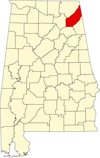
DeKalb County (Alabama)
| County in de Verenigde Staten | |||
|---|---|---|---|
| |||
| Situering | |||
| Staat | Alabama | ||
| Coördinaten | 34°27'26"NB, 85°48'24"WL | ||
| Algemeen | |||
| Oppervlakte | 2.017 km² | ||
| - land | 2.015 km² | ||
| - water | 2 km² | ||
| Inwoners (2000) |
64.452 (32 inw./km²) | ||
| Overig | |||
| Zetel | Fort Payne | ||
| FIPS-code | 01049 | ||
| Opgericht | 1836 | ||
| Website | www | ||
| Foto's | |||

| |||
 Bevolkingspiramide DeKalb County | |||
| Statistieken volkstelling DeKalb County | |||
| |||
DeKalb County is een county in de Amerikaanse staat Alabama.
De county heeft een landoppervlakte van 2.015 km² en telt 64.452 inwoners (volkstelling 2000). De hoofdplaats is Fort Payne.
Bevolkingsontwikkeling
| Jaar | Inwoners | % ± | |
|---|---|---|---|
| 1900 | 23.558 | — | |
| 1910 | 28.261 | 20,0% | |
| 1920 | 34.426 | 21,8% | |
| 1930 | 40.104 | 16,5% | |
| 1940 | 43.075 | 7,4% | |
| 1950 | 45.048 | 4,6% | |
| 1960 | 41.417 | −8,1% | |
| 1970 | 41.981 | 1,4% | |
| 1980 | 53.658 | 27,8% | |
| 1990 | 54.651 | 1,9% | |
| 2000 | 64.452 | 17,9% | |
| Bron: (en) Historical Decennial Census Population | |||