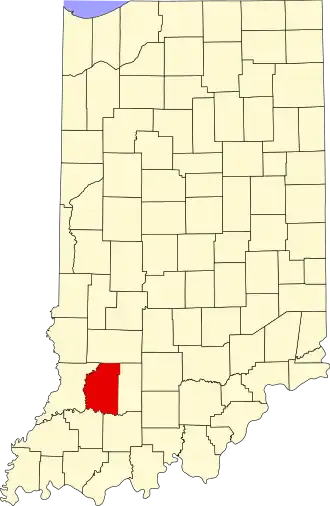
Daviess County (Indiana)
| County in de Verenigde Staten | |||
|---|---|---|---|
| |||
| Situering | |||
| Staat | Indiana | ||
| Coördinaten | 38°42'0"NB, 87°4'48"WL | ||
| Algemeen | |||
| Oppervlakte | 1.131 km² | ||
| - land | 1.115 km² | ||
| - water | 16 km² | ||
| Inwoners (2000) |
29.820 (27 inw./km²) | ||
| Overig | |||
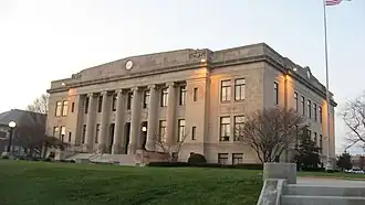
| Zetel | Washington | ||
| FIPS-code | 18027 | ||
| Opgericht | 1816 | ||
| Website | www | ||
| Foto's | |||
| |||
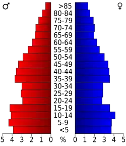 Bevolkingspiramide Daviess County | |||
| Statistieken volkstelling Daviess County | |||
| |||
Daviess County is een county in de Amerikaanse staat Indiana.
De county heeft een landoppervlakte van 1.115 km² en telt 29.820 inwoners (volkstelling 2000). De hoofdplaats is Washington.
Bevolkingsontwikkeling
| Jaar | Inwoners | % ± | |
|---|---|---|---|
| 1900 | 29.914 | — | |
| 1910 | 27.747 | −7,2% | |
| 1920 | 26.856 | −3,2% | |
| 1930 | 25.832 | −3,8% | |
| 1940 | 26.163 | 1,3% | |
| 1950 | 26.762 | 2,3% | |
| 1960 | 26.636 | −0,5% | |
| 1970 | 26.602 | −0,1% | |
| 1980 | 27.836 | 4,6% | |
| 1990 | 27.533 | −1,1% | |
| 2000 | 29.820 | 8,3% | |
| Bron: (en) Historical Decennial Census Population | |||