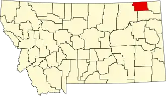
Daniels County
| County in de Verenigde Staten | |||
|---|---|---|---|
| |||
| Situering | |||
| Staat | Montana | ||
| Coördinaten | 48°47'24"NB, 105°33'0"WL | ||
| Algemeen | |||
| Oppervlakte | 3.695 km² | ||
| - land | 3.694 km² | ||
| - water | 1 km² | ||
| Inwoners (2000) |
2.017 (1 inw./km²) | ||
| Overig | |||
| Zetel | Scobey | ||
| FIPS-code | 30019 | ||
| Opgericht | 1920 | ||
| Website | www | ||
| Foto's | |||

| |||
 Bevolkingspiramide Daniels County | |||
| Statistieken volkstelling Daniels County | |||
| |||
Daniels County is een county in de Amerikaanse staat Montana.
De county heeft een landoppervlakte van 3.694 km² en telt 2.017 inwoners (volkstelling 2000). De hoofdplaats is Scobey.