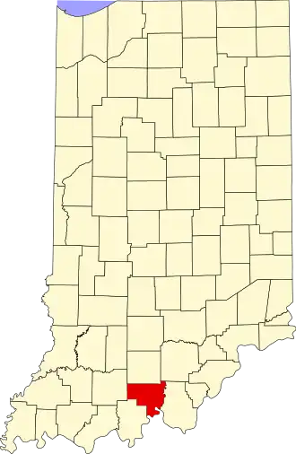
Crawford County (Indiana)
| County in de Verenigde Staten | |||
|---|---|---|---|
| |||
| Situering | |||
| Staat | Indiana | ||
| Coördinaten | 38°17'24"NB, 86°27'36"WL | ||
| Algemeen | |||
| Oppervlakte | 800 km² | ||
| - land | 792 km² | ||
| - water | 8 km² | ||
| Inwoners (2000) |
10.743 (14 inw./km²) | ||
| Overig | |||
| Zetel | English | ||
| FIPS-code | 18025 | ||
| Opgericht | 1818 | ||
| Website | www | ||
| Foto's | |||

| |||
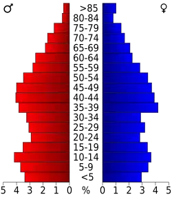 Bevolkingspiramide Crawford County | |||
| Statistieken volkstelling Crawford County | |||
| |||
Crawford County is een county in de Amerikaanse staat Indiana.
De county heeft een landoppervlakte van 792 km² en telt 10.743 inwoners (volkstelling 2000). De hoofdplaats is English.
Bevolkingsontwikkeling
| Jaar | Inwoners | % ± | |
|---|---|---|---|
| 1900 | 13.476 | — | |
| 1910 | 12.057 | −10,5% | |
| 1920 | 11.201 | −7,1% | |
| 1930 | 10.160 | −9,3% | |
| 1940 | 10.171 | 0,1% | |
| 1950 | 9.289 | −8,7% | |
| 1960 | 8.379 | −9,8% | |
| 1970 | 8.033 | −4,1% | |
| 1980 | 9.820 | 22,2% | |
| 1990 | 9.914 | 1,0% | |
| 2000 | 10.743 | 8,4% | |
| Bron: (en) Historical Decennial Census Population | |||