Craighead County
| County in de Verenigde Staten | |||
|---|---|---|---|
| |||
| Situering | |||
| Staat | Arkansas | ||
| Coördinaten | 35°50'25"NB, 90°42'27"WL | ||
| Algemeen | |||
| Oppervlakte | 1.847 km² | ||
| - land | 1.841 km² | ||
| - water | 6 km² | ||
| Inwoners (2000) |
82.148 (45 inw./km²) | ||
| Overig | |||
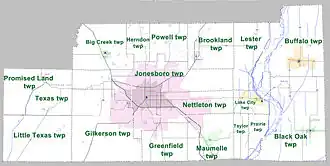
| Zetel | Jonesboro | ||
| FIPS-code | 05031 | ||
| Opgericht | 1859 | ||
| Website | craigheadcounty | ||
| Detailkaart | |||
| |||
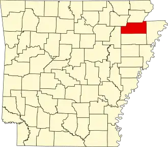
| Overzichtskaart van Craighead County | |||
| Foto's | |||

| |||
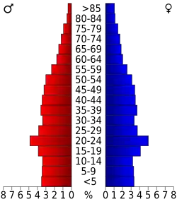 Bevolkingspiramide Craighead County | |||
| Statistieken volkstelling Craighead County | |||
| |||
Craighead County is een county in de Amerikaanse staat Arkansas.
De county heeft een landoppervlakte van 1.841 km² en telt 82.148 inwoners (volkstelling 2000). De hoofdplaats is Jonesboro.
Bevolkingsontwikkeling
| Jaar | Inwoners | % ± | |
|---|---|---|---|
| 1900 | 19.505 | — | |
| 1910 | 27.627 | 41,6% | |
| 1920 | 37.541 | 35,9% | |
| 1930 | 44.740 | 19,2% | |
| 1940 | 47.200 | 5,5% | |
| 1950 | 50.613 | 7,2% | |
| 1960 | 47.303 | −6,5% | |
| 1970 | 52.068 | 10,1% | |
| 1980 | 63.239 | 21,5% | |
| 1990 | 68.956 | 9,0% | |
| 2000 | 82.148 | 19,1% | |
| Bron: (en) Historical Decennial Census Population | |||