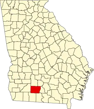
Colquitt County
| County in de Verenigde Staten | |||
|---|---|---|---|
| |||
| Situering | |||
| Staat | Georgia | ||
| Coördinaten | 31°11'24"NB, 83°46'12"WL | ||
| Algemeen | |||
| Oppervlakte | 1.441 km² | ||
| - land | 1.430 km² | ||
| - water | 11 km² | ||
| Inwoners (2000) |
42.053 (29 inw./km²) | ||
| Overig | |||
| Zetel | Moultrie | ||
| FIPS-code | 13071 | ||
| Opgericht | 1856 | ||
| Website | www | ||
| Foto's | |||

| |||
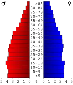 Bevolkingspiramide Colquitt County | |||
| Statistieken volkstelling Colquitt County | |||
| |||
Colquitt County is een county in de Amerikaanse staat Georgia.
De county heeft een landoppervlakte van 1.430 km² en telt 42.053 inwoners (volkstelling 2000). De hoofdplaats is Moultrie.
Bevolkingsontwikkeling
| Jaar | Inwoners | % ± | |
|---|---|---|---|
| 1900 | 13.636 | — | |
| 1910 | 19.789 | 45,1% | |
| 1920 | 29.332 | 48,2% | |
| 1930 | 30.622 | 4,4% | |
| 1940 | 33.012 | 7,8% | |
| 1950 | 33.999 | 3,0% | |
| 1960 | 34.048 | 0,1% | |
| 1970 | 32.200 | −5,4% | |
| 1980 | 35.376 | 9,9% | |
| 1990 | 36.645 | 3,6% | |
| 2000 | 42.053 | 14,8% | |
| Bron: (en) Historical Decennial Census Population | |||
Zie de categorie Colquitt County, Georgia van Wikimedia Commons voor mediabestanden over dit onderwerp.