Clay County (Kansas)
| County in de Verenigde Staten | |||
|---|---|---|---|
| |||
| Situering | |||
| Staat | Kansas | ||
| Coördinaten | 39°21'0"NB, 97°10'12"WL | ||
| Algemeen | |||
| Oppervlakte | 1.698 km² | ||
| - land | 1.668 km² | ||
| - water | 30 km² | ||
| Inwoners (2000) |
8.822 (5 inw./km²) | ||
| Overig | |||
| Zetel | Clay Center | ||
| FIPS-code | 20027 | ||
| Opgericht | 1857 | ||
| Website | claycountykansas | ||
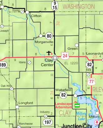
| Detailkaart | |||
| |||
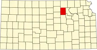
| Overzichtskaart van Clay County | |||
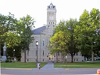
| Foto's | |||
| |||
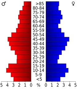 Bevolkingspiramide Clay County | |||
| Statistieken volkstelling Clay County | |||
| |||
Clay County is een county in de Amerikaanse staat Kansas.
De county heeft een landoppervlakte van 1.668 km² en telt 8.822 inwoners (volkstelling 2000). De hoofdplaats is Clay Center.
Bevolkingsontwikkeling
| Jaar | Inwoners | % ± | |
|---|---|---|---|
| 1900 | 15.833 | — | |
| 1910 | 15.251 | −3,7% | |
| 1920 | 14.365 | −5,8% | |
| 1930 | 14.556 | 1,3% | |
| 1940 | 13.281 | −8,8% | |
| 1950 | 11.697 | −11,9% | |
| 1960 | 10.675 | −8,7% | |
| 1970 | 9.890 | −7,4% | |
| 1980 | 9.802 | −0,9% | |
| 1990 | 9.158 | −6,6% | |
| 2000 | 8.822 | −3,7% | |
| Bron: (en) Historical Decennial Census Population | |||