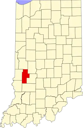
Clay County (Indiana)
| County in de Verenigde Staten | |||
|---|---|---|---|
| |||
| Situering | |||
| Staat | Indiana | ||
| Coördinaten | 39°24'0"NB, 87°6'36"WL | ||
| Algemeen | |||
| Oppervlakte | 933 km² | ||
| - land | 926 km² | ||
| - water | 7 km² | ||
| Inwoners (2000) |
26.556 (29 inw./km²) | ||
| Overig | |||
| Zetel | Brazil | ||
| FIPS-code | 18021 | ||
| Opgericht | 1825 | ||
| Website | www | ||
| Foto's | |||

| |||
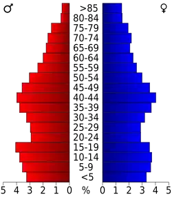 Bevolkingspiramide Clay County | |||
| Statistieken volkstelling Clay County | |||
| |||
Clay County is een county in de Amerikaanse staat Indiana.
De county heeft een landoppervlakte van 926 km² en telt 26.556 inwoners (volkstelling 2000). De hoofdplaats is Brazil.
Bevolkingsontwikkeling
| Jaar | Inwoners | % ± | |
|---|---|---|---|
| 1900 | 34.285 | — | |
| 1910 | 32.535 | −5,1% | |
| 1920 | 29.447 | −9,5% | |
| 1930 | 26.479 | −10,1% | |
| 1940 | 25.365 | −4,2% | |
| 1950 | 23.918 | −5,7% | |
| 1960 | 24.207 | 1,2% | |
| 1970 | 23.933 | −1,1% | |
| 1980 | 24.862 | 3,9% | |
| 1990 | 24.705 | −0,6% | |
| 2000 | 26.556 | 7,5% | |
| Bron: (en) Historical Decennial Census Population | |||