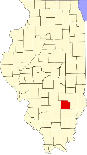
Clay County (Illinois)
| County in de Verenigde Staten | |||
|---|---|---|---|
| |||
| Situering | |||
| Staat | Illinois | ||
| Coördinaten | 38°45'36"NB, 88°29'24"WL | ||
| Algemeen | |||
| Oppervlakte | 1.217 km² | ||
| - land | 1.215 km² | ||
| - water | 2 km² | ||
| Inwoners (2000) |
14.560 (12 inw./km²) | ||
| Overig | |||
| Zetel | Louisville | ||
| FIPS-code | 17025 | ||
| Opgericht | 1824 | ||
| Website | claycountyillinois | ||
| Foto's | |||

| |||
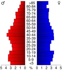 Bevolkingspiramide Clay County | |||
| Statistieken volkstelling Clay County | |||
| |||
Clay County is een county in de Amerikaanse staat Illinois.
De county heeft een landoppervlakte van 1.215 km² en telt 14.560 inwoners (volkstelling 2000). De hoofdplaats is Louisville.
Bevolkingsontwikkeling
| Jaar | Inwoners | % ± | |
|---|---|---|---|
| 1900 | 19.553 | — | |
| 1910 | 18.661 | −4,6% | |
| 1920 | 17.684 | −5,2% | |
| 1930 | 16.155 | −8,6% | |
| 1940 | 18.947 | 17,3% | |
| 1950 | 17.445 | −7,9% | |
| 1960 | 15.815 | −9,3% | |
| 1970 | 14.735 | −6,8% | |
| 1980 | 15.283 | 3,7% | |
| 1990 | 14.460 | −5,4% | |
| 2000 | 14.560 | 0,7% | |
| Bron: (en) Historical Decennial Census Population | |||