Clay County (Georgia)
| County in de Verenigde Staten | |||
|---|---|---|---|
| |||
| Situering | |||
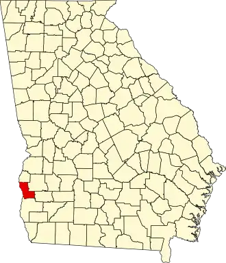
| Staat | Georgia | ||
| Coördinaten | 31°37'12"NB, 84°59'24"WL | ||
| Algemeen | |||
| Oppervlakte | 562 km² | ||
| - land | 506 km² | ||
| - water | 56 km² | ||
| Inwoners (2000) |
3.357 (7 inw./km²) | ||
| Overig | |||
| Zetel | Fort Gaines | ||
| FIPS-code | 13061 | ||
| Opgericht | 1854 | ||
| Website | www | ||
| Foto's | |||

| |||
 Bevolkingspiramide Clay County | |||
| Statistieken volkstelling Clay County | |||
| |||
Clay County is een county in de Amerikaanse staat Georgia.
De county heeft een landoppervlakte van 506 km² en telt 3.357 inwoners (volkstelling 2000). De hoofdplaats is Fort Gaines.
Bevolkingsontwikkeling
| Jaar | Inwoners | % ± | |
|---|---|---|---|
| 1900 | 8.568 | — | |
| 1910 | 8.960 | 4,6% | |
| 1920 | 7.557 | −15,7% | |
| 1930 | 6.943 | −8,1% | |
| 1940 | 7.064 | 1,7% | |
| 1950 | 5.844 | −17,3% | |
| 1960 | 4.551 | −22,1% | |
| 1970 | 3.636 | −20,1% | |
| 1980 | 3.553 | −2,3% | |
| 1990 | 3.364 | −5,3% | |
| 2000 | 3.357 | −0,2% | |
| Bron: (en) Historical Decennial Census Population | |||
Zie de categorie Clay County, Georgia van Wikimedia Commons voor mediabestanden over dit onderwerp.