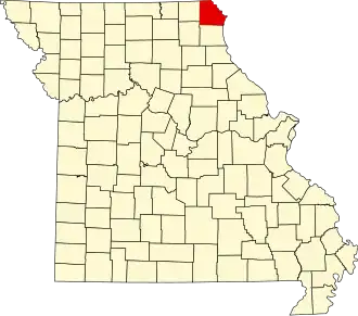
Clark County (Missouri)
| County in de Verenigde Staten | |||
|---|---|---|---|
| |||
| Situering | |||
| Staat | Missouri | ||
| Coördinaten | 40°24'36"NB, 91°44'24"WL | ||
| Algemeen | |||
| Oppervlakte | 1.326 km² | ||
| - land | 1.314 km² | ||
| - water | 12 km² | ||
| Inwoners (2000) |
7.416 (6 inw./km²) | ||
| Overig | |||
| Zetel | Kahoka | ||
| FIPS-code | 29045 | ||
| Opgericht | 1836 | ||
| Website | clarkcountymo | ||
| Foto's | |||

| |||
 Bevolkingspiramide Clark County | |||
| Statistieken volkstelling Clark County | |||
| |||
Clark County is een county in de Amerikaanse staat Missouri.
De county heeft een landoppervlakte van 1.314 km² en telt 7.416 inwoners (volkstelling 2000). De hoofdplaats is Kahoka.
Bevolkingsontwikkeling
| Jaar | Inwoners | % ± | |
|---|---|---|---|
| 1900 | 15.383 | — | |
| 1910 | 12.811 | −16,7% | |
| 1920 | 11.874 | −7,3% | |
| 1930 | 10.254 | −13,6% | |
| 1940 | 10.166 | −0,9% | |
| 1950 | 9.003 | −11,4% | |
| 1960 | 8.725 | −3,1% | |
| 1970 | 8.260 | −5,3% | |
| 1980 | 8.493 | 2,8% | |
| 1990 | 7.547 | −11,1% | |
| 2000 | 7.416 | −1,7% | |
| Bron: (en) Historical Decennial Census Population | |||