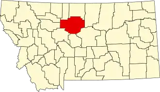
Chouteau County
| County in de Verenigde Staten | |||
|---|---|---|---|
| |||
| Situering | |||
| Staat | Montana | ||
| Coördinaten | 47°52'48"NB, 110°26'24"WL | ||
| Algemeen | |||
| Oppervlakte | 10.353 km² | ||
| - land | 10.291 km² | ||
| - water | 62 km² | ||
| Inwoners (2000) |
5.970 (1 inw./km²) | ||
| Overig | |||
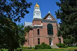
| Zetel | Fort Benton | ||
| FIPS-code | 30015 | ||
| Opgericht | 1887 | ||
| Website | www | ||
| Foto's | |||
| |||
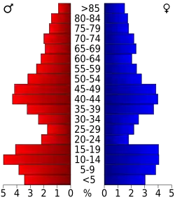 Bevolkingspiramide Chouteau County | |||
| Statistieken volkstelling Chouteau County | |||
| |||
Chouteau County is een county in de Amerikaanse staat Montana.
De county heeft een landoppervlakte van 10.291 km² en telt 5.970 inwoners (volkstelling 2000). De hoofdplaats is Fort Benton.
Bevolkingsontwikkeling
| Jaar | Inwoners | % ± | |
|---|---|---|---|
| 1900 | 10.966 | — | |
| 1910 | 17.191 | 56,8% | |
| 1920 | 11.051 | −35,7% | |
| 1930 | 8.635 | −21,9% | |
| 1940 | 7.316 | −15,3% | |
| 1950 | 6.974 | −4,7% | |
| 1960 | 7.348 | 5,4% | |
| 1970 | 6.473 | −11,9% | |
| 1980 | 6.092 | −5,9% | |
| 1990 | 5.452 | −10,5% | |
| 2000 | 5.970 | 9,5% | |
| Bron: (en) Historical Decennial Census Population | |||