Chorlton
| Civil parish in Engeland | |||
|---|---|---|---|
 | |||
| Situering | |||
| Regio | North West England | ||
| Graafschap | Cheshire | ||
| District | Cheshire West and Chester | ||
| Coördinaten | 53° 1' NB, 2° 49' WL | ||
| Algemeen | |||
| Oppervlakte | 4,8641 km² | ||
| Inwoners (2011) |
124 (25 inw./km²) | ||
| Overig | |||
| Postcode(s) | SY14 | ||
| Netnummer(s) | 01948 | ||
| Grid code | SJ4547 | ||
| Post town | MALPAS | ||
| ONS-code | E04011064 | ||
| Foto's | |||
| |||
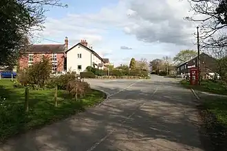
| Straatbeeld in Chorlton | |||
| |||
Chorlton is een civil parish in het bestuurlijke gebied Cheshire West and Chester, in het Engelse graafschap Cheshire met 124 inwoners.
Geplaatst op:
2-8-2010
2-8-2010
Dit artikel is een beginnetje over landen & volken. U wordt uitgenodigd om op bewerken te klikken om uw kennis aan dit artikel toe te voegen.