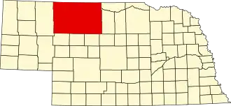
Cherry County
| County in de Verenigde Staten | |||
|---|---|---|---|
| |||
| Situering | |||
| Staat | Nebraska | ||
| Tijdzone | −6 / −7 | ||
| Coördinaten | 42°32'24"NB, 101°7'12"WL | ||
| Algemeen | |||
| Oppervlakte | 15.565 km² | ||
| - land | 15.438 km² | ||
| - water | 127 km² | ||
| Inwoners (2000) |
6.148 (0 inw./km²) | ||
| Overig | |||
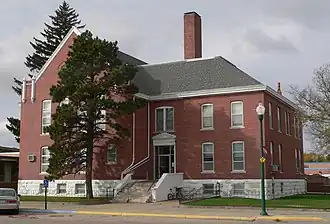
| Zetel | Valentine | ||
| FIPS-code | 31031 | ||
| Opgericht | 1883 | ||
| Website | www | ||
| Foto's | |||
| |||
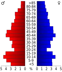 Bevolkingspiramide Cherry County | |||
| Statistieken volkstelling Cherry County | |||
| |||
Cherry County is een county in de Amerikaanse staat Nebraska.
De county heeft een landoppervlakte van 15.438 km² en telt 6.148 inwoners (volkstelling 2000). De hoofdplaats is Valentine.
Geografie
Qua oppervlakte is de county met afstand de grootste van Nebraska. Cherry ligt in twee tijdzones, hetgeen ongebruikelijk is.
Bevolkingsontwikkeling
| Jaar | Inwoners | % ± | |
|---|---|---|---|
| 1900 | 6.541 | — | |
| 1910 | 10.414 | 59,2% | |
| 1920 | 11.753 | 12,9% | |
| 1930 | 10.898 | −7,3% | |
| 1940 | 9.637 | −11,6% | |
| 1950 | 8.397 | −12,9% | |
| 1960 | 8.218 | −2,1% | |
| 1970 | 6.846 | −16,7% | |
| 1980 | 6.758 | −1,3% | |
| 1990 | 6.307 | −6,7% | |
| 2000 | 6.148 | −2,5% | |
| Bron: (en) Historical Decennial Census Population | |||