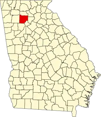
Cherokee County (Georgia)
| County in de Verenigde Staten | |||
|---|---|---|---|
| |||
| Situering | |||
| Staat | Georgia | ||
| Coördinaten | 34°14'24"NB, 84°28'12"WL | ||
| Algemeen | |||
| Oppervlakte | 1.124 km² | ||
| - land | 1.097 km² | ||
| - water | 27 km² | ||
| Inwoners (2000) |
141.903 (129 inw./km²) | ||
| Overig | |||
| Zetel | Canton | ||
| FIPS-code | 13057 | ||
| Opgericht | 1830 | ||
| Website | www | ||
| Foto's | |||

| |||
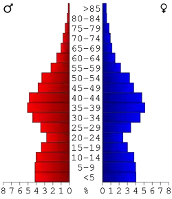 Bevolkingspiramide Cherokee County | |||
| Statistieken volkstelling Cherokee County | |||
| |||
Cherokee County is een county in de Amerikaanse staat Georgia.
De county heeft een landoppervlakte van 1.097 km² en telt 141.903 inwoners (volkstelling 2000). De hoofdplaats is Canton.
Bevolkingsontwikkeling
| Jaar | Inwoners | % ± | |
|---|---|---|---|
| 1900 | 15.243 | — | |
| 1910 | 16.661 | 9,3% | |
| 1920 | 18.569 | 11,5% | |
| 1930 | 20.003 | 7,7% | |
| 1940 | 20.126 | 0,6% | |
| 1950 | 20.750 | 3,1% | |
| 1960 | 23.001 | 10,8% | |
| 1970 | 31.059 | 35,0% | |
| 1980 | 51.699 | 66,5% | |
| 1990 | 90.204 | 74,5% | |
| 2000 | 141.903 | 57,3% | |
| Bron: (en) Historical Decennial Census Population | |||