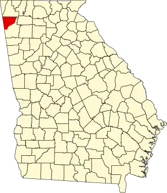
Chattooga County
| County in de Verenigde Staten | |||
|---|---|---|---|
| |||
| Situering | |||
| Staat | Georgia | ||
| Coördinaten | 34°28'48"NB, 85°21'0"WL | ||
| Algemeen | |||
| Oppervlakte | 813 km² | ||
| - land | 812 km² | ||
| - water | 1 km² | ||
| Inwoners (2000) |
25.470 (31 inw./km²) | ||
| Overig | |||
| Zetel | Summerville | ||
| FIPS-code | 13055 | ||
| Opgericht | 1838 | ||
| Website | chattoogacounty | ||
| Foto's | |||

| |||
 Bevolkingspiramide Chattooga County | |||
| Statistieken volkstelling Chattooga County | |||
| |||
Chattooga County is een county in de Amerikaanse staat Georgia.
De county heeft een landoppervlakte van 812 km² en telt 25.470 inwoners (volkstelling 2000). De hoofdplaats is Summerville.
Bevolkingsontwikkeling
| Jaar | Inwoners | % ± | |
|---|---|---|---|
| 1900 | 12.952 | — | |
| 1910 | 13.608 | 5,1% | |
| 1920 | 14.312 | 5,2% | |
| 1930 | 15.407 | 7,7% | |
| 1940 | 18.532 | 20,3% | |
| 1950 | 21.197 | 14,4% | |
| 1960 | 19.954 | −5,9% | |
| 1970 | 20.541 | 2,9% | |
| 1980 | 21.856 | 6,4% | |
| 1990 | 22.242 | 1,8% | |
| 2000 | 25.470 | 14,5% | |
| Bron: (en) Historical Decennial Census Population | |||