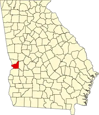
Chattahoochee County
| County in de Verenigde Staten | |||
|---|---|---|---|
| |||
| Situering | |||
| Staat | Georgia | ||
| Coördinaten | 32°21'0"NB, 84°47'24"WL | ||
| Algemeen | |||
| Oppervlakte | 650 km² | ||
| - land | 644 km² | ||
| - water | 6 km² | ||
| Inwoners (2000) |
14.882 (23 inw./km²) | ||
| Overig | |||
| Zetel | Cusseta | ||
| FIPS-code | 13053 | ||
| Opgericht | 1854 | ||
| Website | www | ||
| Foto's | |||

| |||
 Bevolkingspiramide Chattahoochee County | |||
| Statistieken volkstelling Chattahoochee County | |||
| |||
Chattahoochee County is een county in de Amerikaanse staat Georgia.
De county heeft een landoppervlakte van 644 km² en telt 14.882 inwoners (volkstelling 2000). De hoofdplaats is Cusseta.
Bevolkingsontwikkeling
| Jaar | Inwoners | % ± | |
|---|---|---|---|
| 1900 | 5.790 | — | |
| 1910 | 5.586 | −3,5% | |
| 1920 | 5.266 | −5,7% | |
| 1930 | 8.894 | 68,9% | |
| 1940 | 15.138 | 70,2% | |
| 1950 | 12.149 | −19,7% | |
| 1960 | 13.011 | 7,1% | |
| 1970 | 25.813 | 98,4% | |
| 1980 | 21.732 | −15,8% | |
| 1990 | 16.934 | −22,1% | |
| 2000 | 14.882 | −12,1% | |
| Bron: (en) Historical Decennial Census Population | |||