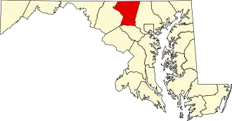
Carroll County (Maryland)
| County in de Verenigde Staten | |||
|---|---|---|---|
| |||
| Situering | |||
| Staat | Maryland | ||
| Coördinaten | 39°34'12"NB, 77°1'12"WL | ||
| Algemeen | |||
| Oppervlakte | 1.171 km² | ||
| - land | 1.163 km² | ||
| - water | 8 km² | ||
| Inwoners (2000) |
150.897 (130 inw./km²) | ||
| Overig | |||
| Zetel | Westminster | ||
| FIPS-code | 24013 | ||
| Opgericht | 1837 | ||
| Website | www | ||
| Foto's | |||

| |||
 Bevolkingspiramide Carroll County | |||
| Statistieken volkstelling Carroll County | |||
| |||
Carroll County is een county in de Amerikaanse staat Maryland.
De county heeft een landoppervlakte van 1.163 km² en telt 150.897 inwoners (volkstelling 2000). De hoofdplaats is Westminster.
Bevolkingsontwikkeling
| Jaar | Inwoners | % ± | |
|---|---|---|---|
| 1900 | 33.860 | — | |
| 1910 | 33.934 | 0,2% | |
| 1920 | 34.245 | 0,9% | |
| 1930 | 35.978 | 5,1% | |
| 1940 | 39.054 | 8,5% | |
| 1950 | 44.907 | 15,0% | |
| 1960 | 52.785 | 17,5% | |
| 1970 | 69.006 | 30,7% | |
| 1980 | 96.356 | 39,6% | |
| 1990 | 123.372 | 28,0% | |
| 2000 | 150.897 | 22,3% | |
| Bron: (en) Historical Decennial Census Population | |||