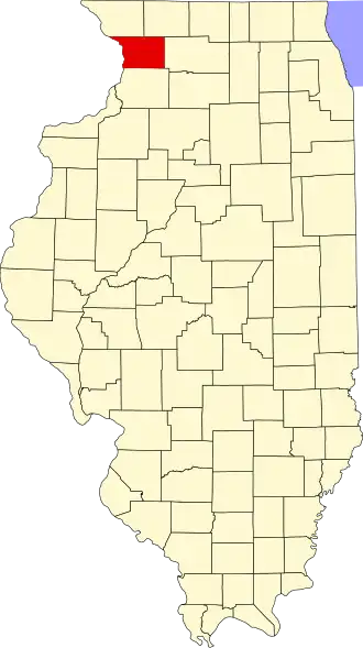
Carroll County (Illinois)
| County in de Verenigde Staten | |||
|---|---|---|---|
| |||
| Situering | |||
| Staat | Illinois | ||
| Coördinaten | 42°3'36"NB, 89°55'12"WL | ||
| Algemeen | |||
| Oppervlakte | 1.206 km² | ||
| - land | 1.150 km² | ||
| - water | 56 km² | ||
| Inwoners (2000) |
16.674 (14 inw./km²) | ||
| Overig | |||
| Zetel | Mount Carroll | ||
| FIPS-code | 17015 | ||
| Opgericht | 1839 | ||
| Website | visitcarrollcountyil | ||
| Foto's | |||

| |||
 Bevolkingspiramide Carroll County | |||
| Statistieken volkstelling Carroll County | |||
| |||
Carroll County is een county in de Amerikaanse staat Illinois.
De county heeft een landoppervlakte van 1.150 km² en telt 16.674 inwoners (volkstelling 2000). De hoofdplaats is Mount Carroll.
Bevolkingsontwikkeling
| Jaar | Inwoners | % ± | |
|---|---|---|---|
| 1900 | 18.963 | — | |
| 1910 | 18.035 | −4,9% | |
| 1920 | 19.345 | 7,3% | |
| 1930 | 18.433 | −4,7% | |
| 1940 | 17.987 | −2,4% | |
| 1950 | 18.976 | 5,5% | |
| 1960 | 19.507 | 2,8% | |
| 1970 | 19.276 | −1,2% | |
| 1980 | 18.779 | −2,6% | |
| 1990 | 16.805 | −10,5% | |
| 2000 | 16.674 | −0,8% | |
| Bron: (en) Historical Decennial Census Population | |||