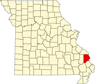
Cape Girardeau County
| County in de Verenigde Staten | |||
|---|---|---|---|
| |||
| Situering | |||
| Staat | Missouri | ||
| Coördinaten | 37°22'48"NB, 89°40'48"WL | ||
| Algemeen | |||
| Oppervlakte | 1.519 km² | ||
| - land | 1.499 km² | ||
| - water | 20 km² | ||
| Inwoners (2000) |
68.693 (46 inw./km²) | ||
| Overig | |||
| Zetel | Jackson | ||
| FIPS-code | 29031 | ||
| Opgericht | 1812 | ||
| Website | www | ||
| Foto's | |||

| |||
 Bevolkingspiramide Cape Girardeau County | |||
| Statistieken volkstelling Cape Girardeau County | |||
| |||
Cape Girardeau County is een county in de Amerikaanse staat Missouri.
De county heeft een landoppervlakte van 1.499 km² en telt 68.693 inwoners (volkstelling 2000). De hoofdplaats is Jackson.
Bevolkingsontwikkeling
| Jaar | Inwoners | % ± | |
|---|---|---|---|
| 1900 | 24.315 | — | |
| 1910 | 27.621 | 13,6% | |
| 1920 | 29.839 | 8,0% | |
| 1930 | 33.203 | 11,3% | |
| 1940 | 37.775 | 13,8% | |
| 1950 | 38.397 | 1,6% | |
| 1960 | 42.020 | 9,4% | |
| 1970 | 49.350 | 17,4% | |
| 1980 | 58.837 | 19,2% | |
| 1990 | 61.633 | 4,8% | |
| 2000 | 68.693 | 11,5% | |
| Bron: (en) Historical Decennial Census Population | |||