Campoussy
| Gemeente in Frankrijk | |||
|---|---|---|---|
.svg.png) | |||
 | |||
| Situering | |||
| Regio | Occitanie | ||
| Departement | Pyrénées-Orientales (66) | ||
| Arrondissement | Prades | ||
| Kanton | Les Pyrénées catalanes | ||
| Coördinaten | 42° 43′ NB, 2° 27′ OL | ||
| Algemeen | |||
| Oppervlakte | 17,04 km² | ||
| Inwoners (1 januari 2022) |
42[1] (2 inw./km²) | ||
| Hoogte | 391 - 1144 m | ||
| Burgemeester | Alain Boyer (maart 1983) | ||
| Overig | |||
| Postcode | 66730 | ||
| INSEE-code | 66035 | ||
| Website | Officiële website | ||
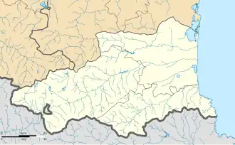
| Detailkaart | |||
 | |||
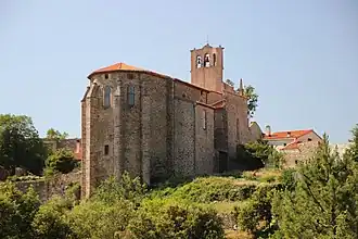
| Foto's | |||
| |||
| Kerk Saint-Etienne | |||
| |||
Campoussy is een gemeente in het Franse departement Pyrénées-Orientales (regio Occitanie) en telt 45 inwoners (2009). De plaats maakt deel uit van het arrondissement Prades.
Geografie
De oppervlakte van Campoussy bedraagt 20,0 km², de bevolkingsdichtheid is dus 2,3 inwoners per km².

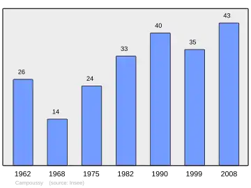
Demografie
Onderstaande figuur toont het verloop van het inwonertal (bron: INSEE-tellingen).
Externe links
- Informatie over Campoussy
- (fr) Statistische informatie op de website van het Franse bureau voor statistiek INSEE
Zie de categorie Campoussy van Wikimedia Commons voor mediabestanden over dit onderwerp.
- ↑ Populations de référence 2022.