Calhoun County (Illinois)
| County in de Verenigde Staten | |||
|---|---|---|---|
| |||
| Situering | |||
| Staat | Illinois | ||
| Coördinaten | 39°9'36"NB, 90°40'12"WL | ||
| Algemeen | |||
| Oppervlakte | 734 km² | ||
| - land | 657 km² | ||
| - water | 77 km² | ||
| Inwoners (2000) |
5.084 (8 inw./km²) | ||
| Overig | |||
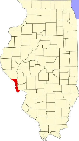
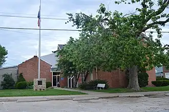
| Zetel | Hardin | ||
| FIPS-code | 17013 | ||
| Opgericht | 1825 | ||
| Foto's | |||
| |||
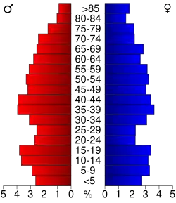 Bevolkingspiramide Calhoun County | |||
| Statistieken volkstelling Calhoun County | |||
| |||
Calhoun County is een county in de Amerikaanse staat Illinois.
De county heeft een landoppervlakte van 657 km² en telt 5.084 inwoners (volkstelling 2000). De hoofdplaats is Hardin.
Bevolkingsontwikkeling
| Jaar | Inwoners | % ± | |
|---|---|---|---|
| 1900 | 8.917 | — | |
| 1910 | 8.610 | −3,4% | |
| 1920 | 8.245 | −4,2% | |
| 1930 | 8.034 | −2,6% | |
| 1940 | 8.207 | 2,2% | |
| 1950 | 6.898 | −15,9% | |
| 1960 | 5.933 | −14,0% | |
| 1970 | 5.675 | −4,3% | |
| 1980 | 5.867 | 3,4% | |
| 1990 | 5.322 | −9,3% | |
| 2000 | 5.084 | −4,5% | |
| Bron: (en) Historical Decennial Census Population | |||