Caldecott (Rutland)
| Civil parish in Engeland | |||
|---|---|---|---|
 | |||
| Situering | |||
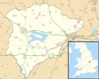
| Regio | East Midlands | ||
| Graafschap | Rutland | ||
| District | Rutland | ||
| Coördinaten | 52° 32' NB, 0° 43' WL | ||
| Algemeen | |||
| Oppervlakte | 7,9981 km² | ||
| Inwoners (2011) |
269 (34 inw./km²) | ||
| Overig | |||
| Postcode(s) | LE15 | ||
| Netnummer(s) | 01536 | ||
| Grid code | SP868937 | ||
| Post town | MARKET HARBOROUGH | ||
| ONS-code | E04000635 | ||
| Foto's | |||
| |||
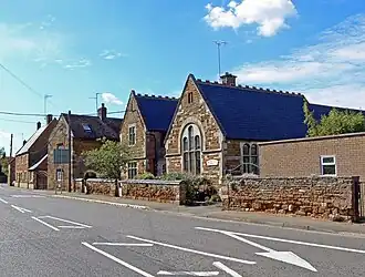
| Straatbeeld met school in Caldecott | |||
| |||
Caldecott is een civil parish in het bestuurlijke gebied Rutland, in het Engelse graafschap Rutland met 269 inwoners.
Geplaatst op:
16-8-2010
16-8-2010
Dit artikel is een beginnetje over landen & volken. U wordt uitgenodigd om op bewerken te klikken om uw kennis aan dit artikel toe te voegen.