Burke County (Georgia)
| County in de Verenigde Staten | |||
|---|---|---|---|
| |||
| Situering | |||
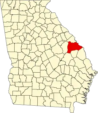
| Staat | Georgia | ||
| Coördinaten | 33°3'36"NB, 82°0'0"WL | ||
| Algemeen | |||
| Oppervlakte | 2.163 km² | ||
| - land | 2.151 km² | ||
| - water | 12 km² | ||
| Inwoners (2000) |
22.243 (10 inw./km²) | ||
| Overig | |||
| Zetel | Waynesboro | ||
| FIPS-code | 13033 | ||
| Opgericht | 1777 | ||
| Website | www | ||
| Foto's | |||

| |||
 Bevolkingspiramide Burke County | |||
| Statistieken volkstelling Burke County | |||
| |||
Burke County is een county in de Amerikaanse staat Georgia.
De county heeft een landoppervlakte van 2.151 km² en telt 22.243 inwoners (volkstelling 2000). De hoofdplaats is Waynesboro.
Bevolkingsontwikkeling
| Jaar | Inwoners | % ± | |
|---|---|---|---|
| 1900 | 30.165 | — | |
| 1910 | 27.268 | −9,6% | |
| 1920 | 30.836 | 13,1% | |
| 1930 | 29.224 | −5,2% | |
| 1940 | 26.520 | −9,3% | |
| 1950 | 23.458 | −11,5% | |
| 1960 | 20.596 | −12,2% | |
| 1970 | 18.255 | −11,4% | |
| 1980 | 19.349 | 6,0% | |
| 1990 | 20.579 | 6,4% | |
| 2000 | 22.243 | 8,1% | |
| Bron: (en) Historical Decennial Census Population | |||
Zie de categorie Burke County, Georgia van Wikimedia Commons voor mediabestanden over dit onderwerp.