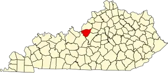
Bullitt County
| County in de Verenigde Staten | |||
|---|---|---|---|
| |||
| Situering | |||
| Staat | Kentucky | ||
| Coördinaten | 37°58'12"NB, 85°42'0"WL | ||
| Algemeen | |||
| Oppervlakte | 778 km² | ||
| - land | 775 km² | ||
| - water | 3 km² | ||
| Inwoners (2020) |
82.217 (106 inw./km²) | ||
| Overig | |||
| Zetel | Shepherdsville | ||
| FIPS-code | 21029 | ||
| Opgericht | 1796 | ||
| Website | bullittcounty | ||
| Foto's | |||

| |||
 Bevolkingspiramide Bullitt County | |||
| Statistieken volkstelling Bullitt County | |||
| |||
Bullitt County is een county in de Amerikaanse staat Kentucky.
De county heeft een landoppervlakte van 775 km² en telt 82.217 inwoners (volkstelling 2020). De hoofdplaats is Shepherdsville en de dichtstbevolkte stad is Mount Washington.
Bevolkingsontwikkeling
| Jaar | Inwoners | % ± | |
|---|---|---|---|
| 1900 | 9.602 | — | |
| 1910 | 9.487 | −1,2% | |
| 1920 | 9.328 | −1,7% | |
| 1930 | 8.868 | −4,9% | |
| 1940 | 9.511 | 7,3% | |
| 1950 | 11.349 | 19,3% | |
| 1960 | 15.726 | 38,6% | |
| 1970 | 26.090 | 65,9% | |
| 1980 | 43.346 | 66,1% | |
| 1990 | 47.567 | 9,7% | |
| 2000 | 61.236 | 28,7% | |
| 2010 | 74.319 | 21,4% | |
| 2020 | 82.217 | 10,6% | |
| Bron: (en) Historical Decennial Census Population | |||