Broxtowe
| Niet-metropolitaans district in Engeland | |||
|---|---|---|---|
| |||
| Situering | |||
| Land | Engeland | ||
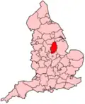
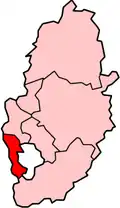
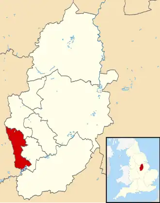
| County | Nottinghamshire | ||
| Regio | East Midlands | ||
| Coördinaten | 52°57'0"NB, 1°16'12"WL | ||
| Algemeen | |||
| Oppervlakte | 80,0989[1] km² | ||
| Inwoners (2001) |
107.570 (1343 inw./km²) | ||
| ONS-code | E07000172 | ||
| Website | www | ||
| Detailkaart | |||
| |||
| |||
Broxtowe is een Engels district in het shire-graafschap (non-metropolitan county OF county) Nottinghamshire en telt 107.570 inwoners. De oppervlakte bedraagt 80 km².
Van de bevolking is 16,4% ouder dan 65 jaar. De werkloosheid bedraagt 2,6% van de beroepsbevolking (cijfers volkstelling 2001).
Civil parishes in district Broxtowe
Awsworth, Brinsley, Cossall, Eastwood, Greasley, Kimberley, Nuthall, Stapleford, Strelley, Trowell.
Bronnen, noten en/of referenties
- ↑ Office for National Statistics → Download → SAM_for_Administrative_Areas_(2017).zip → SAM_LAD_DEC_2017_UK.xlsx. Gearchiveerd op 9 mei 2019.