Brown County (Illinois)
| County in de Verenigde Staten | |||
|---|---|---|---|
| |||
| Situering | |||
| Staat | Illinois | ||
| Coördinaten | 39°57'NB, 90°45'WL | ||
| Algemeen | |||
| Oppervlakte | 796 km² | ||
| - land | 792 km² | ||
| - water | 4 km² | ||
| Inwoners (2000) |
6.950 (9 inw./km²) | ||
| Overig | |||
| Zetel | Mount Sterling | ||
| FIPS-code | 17009 | ||
| Opgericht | 1839 | ||
| Website | browncountyil | ||
| Foto's | |||

| |||
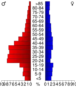 Bevolkingspiramide Brown County | |||
| Statistieken volkstelling Brown County | |||
| |||
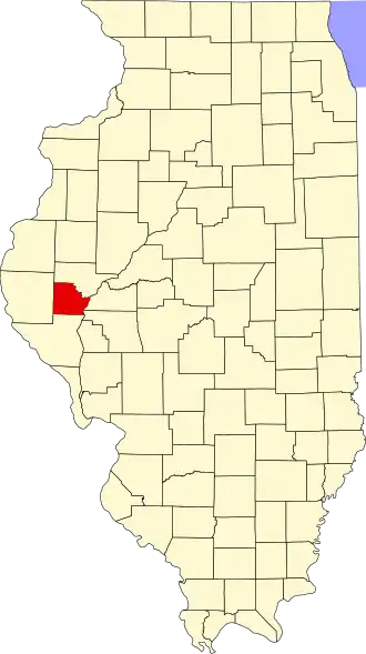
Brown County is een county in de Amerikaanse staat Illinois.
De county heeft een landoppervlakte van 792 km² en telt 6.950 inwoners (volkstelling 2000). De hoofdplaats is Mount Sterling.
Bevolkingsontwikkeling
| Jaar | Inwoners | % ± | |
|---|---|---|---|
| 1900 | 11.557 | — | |
| 1910 | 10.397 | −10,0% | |
| 1920 | 9.336 | −10,2% | |
| 1930 | 7.892 | −15,5% | |
| 1940 | 8.053 | 2,0% | |
| 1950 | 7.132 | −11,4% | |
| 1960 | 6.210 | −12,9% | |
| 1970 | 5.586 | −10,0% | |
| 1980 | 5.411 | −3,1% | |
| 1990 | 5.836 | 7,9% | |
| 2000 | 6.950 | 19,1% | |
| Bron: (en) Historical Decennial Census Population | |||