Bretherton
| Civil parish in Engeland | |||
|---|---|---|---|
 | |||
| Situering | |||
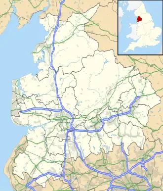
| Regio | North West England | ||
| Graafschap | Lancashire | ||
| District | Chorley | ||
| Coördinaten | 53° 41' NB, 2° 48' WL | ||
| Algemeen | |||
| Oppervlakte | 9,8077 km² | ||
| Inwoners (2011) |
669 (71 inw./km²) | ||
| Overig | |||
| Postcode(s) | PR26 | ||
| Netnummer(s) | 01772 | ||
| Grid code | SD475205 | ||
| Post town | LEYLAND | ||
| ONS-code | E04005143 | ||
| Foto's | |||
| |||
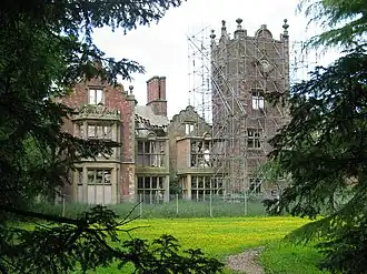
| Bank Hall Tower | |||
| |||
Bretherton is een civil parish in het bestuurlijke gebied Chorley, in het Engelse graafschap Lancashire met 669 inwoners.
Geplaatst op:
3-8-2010
3-8-2010
Dit artikel is een beginnetje over landen & volken. U wordt uitgenodigd om op bewerken te klikken om uw kennis aan dit artikel toe te voegen.