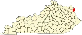
Boyd County (Kentucky)
| County in de Verenigde Staten | |||
|---|---|---|---|
| |||
| Situering | |||
| Staat | Kentucky | ||
| Coördinaten | 38°21'36"NB, 82°41'24"WL | ||
| Algemeen | |||
| Oppervlakte | 419 km² | ||
| - land | 415 km² | ||
| - water | 4 km² | ||
| Inwoners (2000) |
49.752 (120 inw./km²) | ||
| Overig | |||
| Zetel | Catlettsburg | ||
| FIPS-code | 21019 | ||
| Opgericht | 1860 | ||
| Website | www | ||
| Foto's | |||

| |||
 Bevolkingspiramide Boyd County | |||
| Statistieken volkstelling Boyd County | |||
| |||
Boyd County is een county in de Amerikaanse staat Kentucky.
De county heeft een landoppervlakte van 415 km² en telt 49.752 inwoners (volkstelling 2000). De hoofdplaats is Catlettsburg en de dichtstbevolkte stad is Ashland.
Bevolkingsontwikkeling
| Jaar | Inwoners | % ± | |
|---|---|---|---|
| 1900 | 18.834 | — | |
| 1910 | 23.444 | 24,5% | |
| 1920 | 29.281 | 24,9% | |
| 1930 | 43.849 | 49,8% | |
| 1940 | 45.938 | 4,8% | |
| 1950 | 49.949 | 8,7% | |
| 1960 | 52.163 | 4,4% | |
| 1970 | 52.376 | 0,4% | |
| 1980 | 55.513 | 6,0% | |
| 1990 | 51.150 | −7,9% | |
| 2000 | 49.752 | −2,7% | |
| Bron: (en) Historical Decennial Census Population | |||